Article by Samantha Sinclair and storm alert center chief forecaster Daniel Wilson
Are you ready for another cold blast? Here is the latest with chief caster Daniel Wilson. For up-to-date weather information please follow the storm alert center on Facebook.
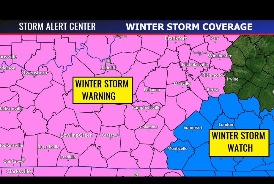
3:00 AM UPDATE (please share) — AS WE MENTIONED IN LAST NIGHT’S UPDATE, A WINTER STORM WARNING IS NOW IN EFFECT:
FROM 3 AM CST /4 AM EST/ FRIDAY TO 6 AM CST /7 AM EST/ SATURDAY…
TIMING: Expect Snow to Begin Mid Morning on Friday
LOCATIONS: All of Kentucky basically west of I-75. Everyone else will be in a winter storm watch.
WHAT…Heavy snow expected. Total snow accumulations of 3 to 6
inches are expected. Along the Kentucky and Tennessee border, 4
to 6 inches with locally higher amounts are expected.
WHERE…Portions of east central, north central, northwest, and
south central Kentucky.
IMPACTS…Roads, and especially bridges and overpasses, will
likely become slick and hazardous. The Friday afternoon commute
will be negatively impacted.
FORECAST NOTES: HIGH IMPACT snow will begin west to east around midnight and progress east. Be aware all day of significant accumulating snowfall.
