Storm alert center chief forecaster Daniel Wilson
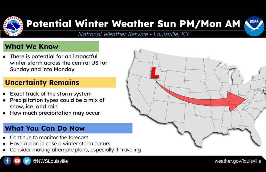
PLEASE SHARE: Here is the latest weather update….First of all we are still in the UNCERTAINTY MODE as to what will happen Sunday – Monday but here is the current setup.
Most of the data is indicating sleet and freezing rain along with snow on top of that across a large part of Kentucky bringing an ice storm potential.
Simply stated, if the low pressure tracks farther south, our precipitation will fall as mostly all snow. If it tracks near us in southern Kentucky, we will see more of a sleet, freezing rain and snow.
If the low pressure is well to the north of us, rain and a wintry mix could be expected with no real impact.
Behind all this will be an arctic blast of cold temperatures, possibly in the teens Friday and Saturday night with even more brutal temperatures later. BE WINTER WEATHER AWARE!
Now is the time to make your winter preparations, and ensure your plumbing is ready for the cold weather. 
